Map Help
How to use the map
This page shows pictures of the map controls and says how you can use them.
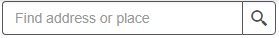
Search field - enter a postcode or placename and select from the list of results to zoom to that location.


Using Keyboard navigation
The map can be navigated using a keyboard.
Press Tab to go forward and (Shift + Tab) to go backwards between sections and controls. Pressing Enter focuses inside a section or control, for example, activating the buttons for zoom or full screen. Pressing Esc focuses outside the section or control.
Inside the map contents menu, Tab to a section, for example, River Flooding, then press Enter to expand or collapse the section or to check or uncheck the tickboxes.
Press Esc to exit a section.
Changing to a greyscale map background
Select the background map menu button and select the greyscale option.
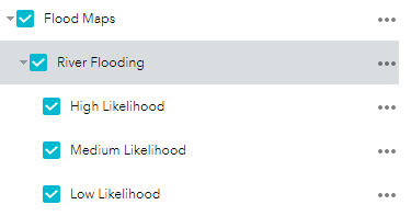
Changing the map contents
Select the Map Contents menu to check or uncheck the tickboxes beside the
flood maps and likelihoods you want to display.
If you don’t see flood risk areas on the map
Try zooming in on the map a few times. Check the map contents menu to make sure that
flood risk maps are selected. If you still cannot see any flood risk areas, you may be looking
at a place which does not have identified flood risk. Try searching for a different location.
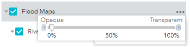
Changing the transparency of the flood risk areas
Select the three dots next to Flood Maps at the top of the map contents menu and choose
Transparency and adjust the slider. This changes the transparency on all the flood risk
areas.
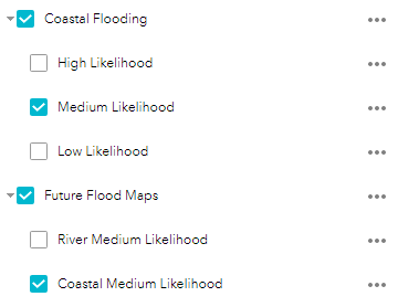
Comparing present and future flood risk
Future risk is only provided for a medium likelihood. Compare with the same present
likelihood. For example, Future Coastal Medium Likelihood with present day Coastal
Medium Likelihood.